|
Reported Crop Circles for the State of
Ohio -
Yellow Springs, Greene County (August 12, 2005)
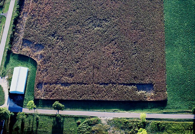
A series of RDF in two fields on either side of Jacoby Creek in corn were reported near the town of Yellow Springs, after a strong weather front passes through the area. The flattened areas were spotted by a farmer-pilot who owns a grass landing strip across the street from the field with the main damage. His corn field across the street was completely undamaged / unaffected.

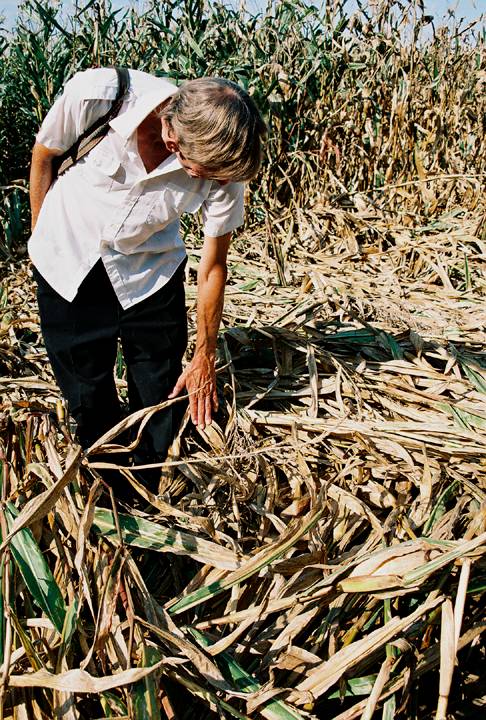
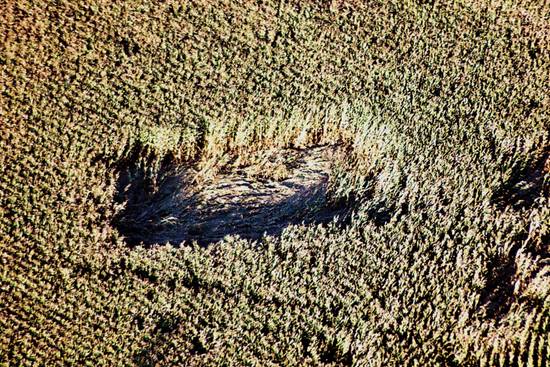
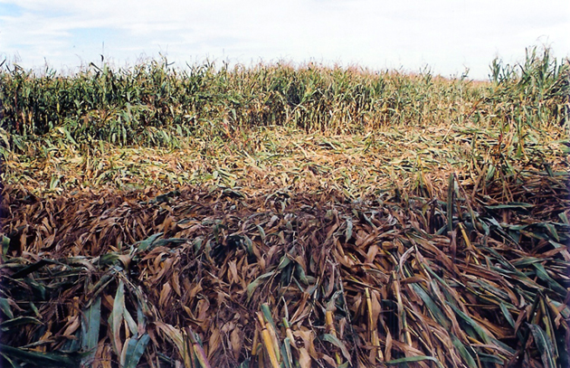
The corn in the affected field was bent at various heights ranging from flat to the ground, to being bent (but not broken) at 5-6 feet off the ground, with several areas only being flattened to about knee-high. While there were a few large areas where the corn was flattened to the ground, the entirety of the field was “pockmarked” with RDF. One flattened area was radially laid, and many stalks exhibited 180 degree bends.


The flattened corn was measured to be L-NEAT positive for node elongation. No unusual E-M or radiation readings were detected, although that is not unusual because the formation was not investigated for approximately three weeks after the date of formation.
The field is located relatively near the Native American Indian mound, Orators’ Mound, in Yellow Springs.
Crop type: corn
Source: ICCRA investigation
Photos: Jeffrey Wilson |
|
City / County / Date:
- Middletown,
Butler County (1941)
- Carolton
(now Carrolton / Center Township), Carrol County (1960)
- Dellroy,
Carroll County
(June 26, 1965)
- Gallipolis,
Gallia County (November 1966)
- Rush
County (1968)
- Meigs
County (1968)
- Columbus,
Franklin County (October 16, 1973)
- Mariemont,
Hamilton County (January 4, 1975)
- Lancaster,
Fairfield County (1977)
- Oak
Harbor, Ottawa County (1979)
- Helena,
Guernsey County (1986)
- Millersburg,
Holmes County (November 10, 1989)
- Millersburg,
Holmes County (February, 1991)
- Dundee,
Tuscarawas County (March 20, 1992)
- Austinberg
/ Ashtabula, Ashtabula County
(August 30, 1992)
- Worthington,
Franklin County (April 1995)
- Paulding
/ Jackson Township, Paulding County (July 4, 1996)
- Sugar
Creek Township / Elida, Allen County (August 1, 1996)
- Payne,
Paulding County
(June 27, 1997)
- Broughton
/ Latty Township, Paulding County (June 27, 1998)
- Lafayette,
Allen County
(June 1999)
- Bainbridge,
Ross County
(June 29, 2000)
- Careytown,
Highland County (June 24, 2002)
- Sardinia,
Brown County
(June 30, 2002)
- Locust
Grove, Adams County (August 24, 2003)
- Bourneville,
Ross County (September 6, 2003)
- Paint
Creek Island, Bainbridge, Ross County
(September 25, 2003)
- West
Union, Adams County (October 25, 2003)
- Cuba,
Clinton County
(June 15, 2004)
- Hillsboro,
Highland County
(July 5, 2004)
- West
Union, Adams County (August 16, 2004)
- Miamisburg,
Montgomery County (August 24, 2004)
- Rarden,
Scioto County (September 15, 2004)
- Patterson’s
Corner, Greene County (July 5, 2005)
- Yellow
Springs, Greene County (August 12, 2005)
- Fairfax,
Highland County
(April 21, 2006)
- Eagle
Township, Brown County (May 21, 2006)
- Newbury, Geauga
County
(July 7, 2006)
- Sandyville,
Tuscarawas County (July 22, 2006)
- Bucyrus, Crawford
County (August 31, 2006)
- Madisonburg,
Wayne County (September 1, 2007)
- Moscow, Clermont County
(June 6, 2010)
- Owensville, Clermont County (June 24, 2010)
- Chillicothe, Ross County
(Mid Sept 2012)
|


